Surveying
Harnessing LiDAR: High-Precision 3D Laser Scanning Solutions
Smart Surveying Solutions with LiDAR & Drone Mapping
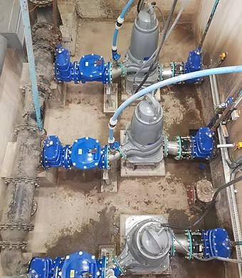
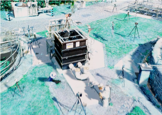
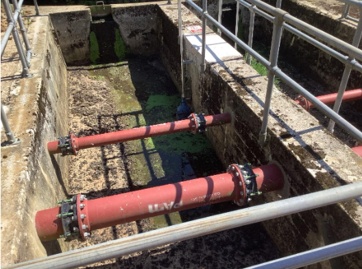
3D Laser Scan Surveying (LiDAR) provides a precise and comprehensive solution for data capture as well as significantly reducing the amount of time required on site. It is far less intrusive than traditional surveying methods and there is no requirement for physical contact with machinery, equipment or structures. This is useful when working in operational and confined spaces and significantly reduces or eliminates down time.The output of the survey when all scans are stitched together is 3d Point Cloud. This can be used to take high accuracy measurements and for 3d modelling.Laser scanning technology continues to develop rapidly and BIMTek strive to keep up to date with the latest advances in order to provide the most effective surveying service.
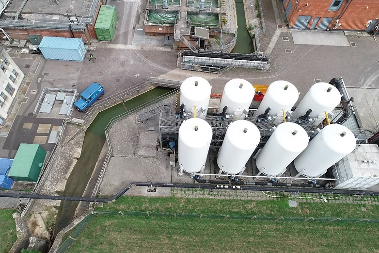
The recent rapid advancement of drone technology has allowed for a safe, fast and cost-effective method to survey at height. Drones are now capable of carrying a range of sensors, including high resolution cameras; LiDAR scanners; thermal imaging cameras; all allowing a range of services to be performed from the air.
BIMTek have a trained Remote Pilot and a Permission for Commercial Operation (PfCO) from the Civil Aviation Authority. With our inhouse drone we can carry out inspection surveys, photo surveys, aerial videography as well as photogrammetry to produce 3d Point clouds, 3d mesh models etc.
3d Point Clouds produced from photogrammetry may result in slightly higher tolerances than Laser Scanning methods however the large open areas can be survey quickly and effectively.
FAQ's
BIMTek combines advanced surveying technology with industry expertise to deliver accurate and efficient digital engineering solutions. Using modern LiDAR scanners, drones, BIM software, and 3D modelling tools, BIMTek provides reliable data capture and high-quality project deliverables tailored to client requirements. The company focuses on reducing project downtime, improving safety, and supporting seamless collaboration through precise digital workflows. With experience in laser scanning, photogrammetry, drone inspections, and BIM integration, BIMTek helps clients achieve better project outcomes while saving time and costs. Their commitment to innovation and accuracy ensures dependable surveying solutions for complex engineering and construction projects.
Many industries benefit from 3D laser scanning and drone surveying services due to their accuracy, speed, and efficiency. Construction companies use these technologies for BIM coordination, progress tracking, and site analysis. Industrial facilities rely on laser scanning for plant modelling, maintenance planning, and asset documentation. Infrastructure and civil engineering projects use drone surveys for road, bridge, and utility inspections. Architects and property developers utilise point cloud data for renovation and restoration projects. Additionally, energy, manufacturing, mining, and environmental sectors benefit from detailed aerial mapping and digital modelling. These technologies support safer operations, improved planning, and more informed decision-making across multiple industries.
A 3D point cloud is a digital representation of a physical environment created from millions of measured points captured during a laser scan or photogrammetry survey. Each point contains precise spatial coordinates that collectively form an accurate 3D model of the surveyed area. Point clouds are essential for BIM modelling, engineering design, clash detection, renovation planning, and asset management. They allow project teams to analyse existing conditions with a high level of detail and accuracy before construction or maintenance begins. By using point cloud data, businesses can improve project coordination, reduce costly errors, and streamline the overall design and construction workflow.
Drone surveying has become an efficient and cost-effective solution for capturing aerial data across large or hard-to-reach areas. Modern drones equipped with high-resolution cameras, LiDAR scanners, and thermal imaging sensors can quickly collect accurate site information from above. Drone surveys are commonly used for topographical mapping, inspections, construction monitoring, photogrammetry, and infrastructure analysis. They significantly reduce the risks associated with working at height while improving project efficiency. The captured aerial data can be converted into 3D point clouds, orthomosaic maps, and digital terrain models. Drone technology enables faster site assessments and provides valuable visual insights for planning and decision-making.
LiDAR surveying services provide fast, accurate, and reliable data capture for construction, engineering, and infrastructure projects. One of the main advantages is the ability to gather millions of measurements in a short amount of time while minimising disruption to operations. LiDAR surveys improve project accuracy, reduce human error, and enhance safety by eliminating the need for physical contact with hazardous or difficult-to-access areas. The generated 3D point cloud data supports BIM workflows, asset management, and digital modelling. Additionally, LiDAR technology helps reduce project downtime, speeds up decision-making, and improves collaboration between project stakeholders throughout the design and construction process.
3D laser scanning surveying is an advanced data capture method that uses LiDAR technology to collect highly accurate measurements of buildings, structures, machinery, and environments. The laser scanner rapidly captures millions of data points to create a detailed 3D point cloud model. This process allows surveyors and engineers to analyse spaces with exceptional precision while reducing time spent on site. Unlike traditional surveying methods, laser scanning is non-contact and minimally intrusive, making it ideal for operational facilities, confined spaces, and complex industrial environments. The collected data can then be used for BIM modelling, engineering design, clash detection, and project planning.
General Enquiry
Build Smarter with BIMTek
Unlock the full potential of digital engineering with BIMTek Limited. By combining advanced 3D laser scanning, intelligent BIM modelling, and practical engineering expertise, we provide a connected approach that improves coordination across every stage of your project. Our workflows are designed to enhance visibility, minimise uncertainty, and help teams make informed decisions with confidence.
Whether you’re delivering complex infrastructure or tackling detailed design challenges, we focus on turning accurate data into clear, buildable solutions. From reducing costly errors to accelerating timelines, our team supports you with reliable insights and efficient processes—ensuring your project runs smoothly from initial concept through to final delivery.